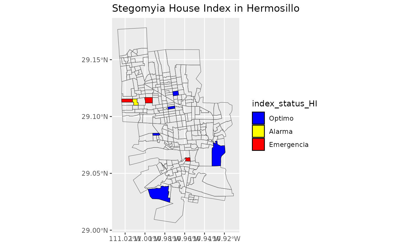
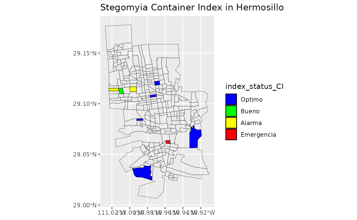
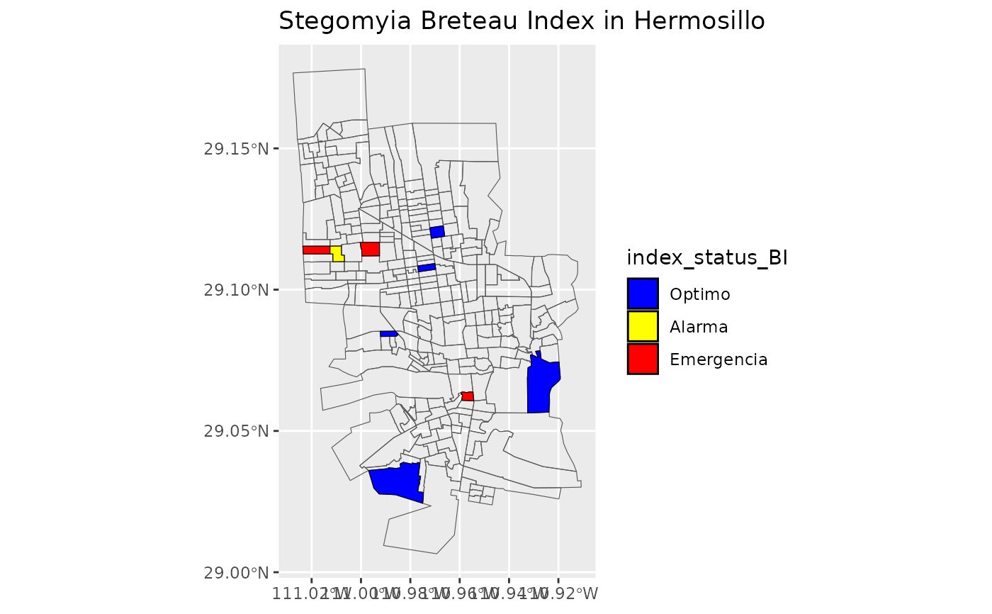
get_maps_stegomyia_indices
get_maps_stegomyia_indices.RdThis function generates maps for three Stegomyia indices (Entomological Risk Indices) of dataframe make to funtion get_stegomyia_indices_by_type_of_study_and_geo_is. This data frame containing information about sectors and their corresponding indices.
Arguments
- df
the dataframe with information processed by the function "get_stegomyia_indices_by_type_of_study_and_geo_is" or "get_stegomyia_indices_by_type_of_study_and_star_date".
- m1
is a shapefile"ejercicio_sectores_hermosillo.shp" with geographic information of hermosillo city for join dataframe with information of indices stegomyia
- m0
is a shapefile "ejercicio_sectores_hermosillo2.shp" with limit of sectors of hermosillo city. This shapefile use to fution with m1 and give limits of the sectors and the hermosillo city
print(maps$HI) # Print the map for the House Index print(maps$CI) # Print the map for the Container Index print(maps$BI) # Print the map for the Breteau Index
Value
listmaps: A list of three ggplot objects representing the maps for different Stegomyia indices.
Examples
Sindx_maps <- get_maps_stegomyia_indices(df_for_map)
#> Warning: GDAL Error 1: PROJ: defmodel: Cannot open nz_linz_nzgd2000-20180701.json
#> Warning: GDAL Error 1: PROJ: pipeline: Pipeline: Bad step definition: proj=defmodel (File not found or invalid)
#> Warning: GDAL Error 1: PROJ: defmodel: Cannot open nz_linz_nzgd2000-20180701.json
#> Warning: GDAL Error 1: PROJ: pipeline: Pipeline: Bad step definition: proj=defmodel (File not found or invalid)
Sindx_maps
#> [[1]]
 #>
#> [[2]]
#>
#> [[2]]
 #>
#> [[3]]
#>
#> [[3]]
 #>
#>